

Torres del Paine is a Chilean National Park encompassing a mountains, glacier, lake, and river-rich area in southern Chile. The Cordillera del Paine is the centerpiece of the park. It lies in a transition area between the Magellanic subpolar forests and the Patagonian Steppes. The park is located 112 km north of Puerto Natales. Bernardo O'Higgins National Park is its neighbour to the west, while Los Glaciares National Park is located to the north in Argentine territory.
Torres del Paine was labeled as a World Biosphere Reserve by UNESCO in 1978. Cougars, foxes and guanacos are the most prevalent animal species found in the Torres del Paine.
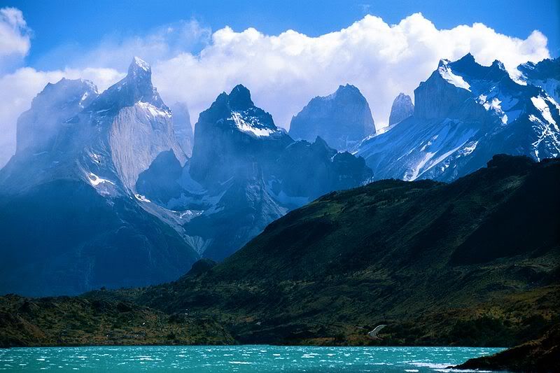
The landscape of the park is dominated by the Paine massif, which is an eastern spur of the Andes located on the east side of the Grey Glacier, rising dramatically above the Patagonian steppe.
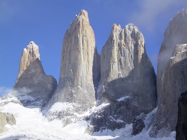
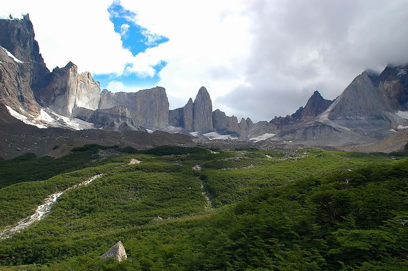
Small valleys separate the spectacular granite spires and mountains of the massif. These are: Valle del Francés (French Valley), Valle Bader, Valle Ascencio, and Valle del Silencio (Silence Valley).
The head of French Valley is a cirque formed by impressive cliffs. To west rise abruptly the colossal walls of Cerro Cota 2000 and Cerro Catedral. The former is named for its elevation (the highest contour line is about 2,000 m) and the latter is named so because its east face resembles a cathedral's facade. To the north stands the granite arête called Aleta de Tiburón (Shark's Fin). To the east, from north to south, lie the peaks Fortaleza (Fortress), La Espada (The Sword), La Hoja (The Blade), La Máscara (The Mummer), Cuerno Norte (North Horn), and Cuerno Principal (Main Horn).
Silence Valley is where standing face to face the gigantic granite walls of Cerro Fortaleza and Cerro Escudo (Shield Hill) with the western faces of the Torres del Paine. Ascencio Valley is the normal route to reach the Torres del Paine lookout, which is located at the bank of a milky green tarn. The highest mountain of the group is Paine Grande, although its elevation has not been determined with precision.

Among the lakes are the Dickson Lake, Nordenskjöld Lake, Pehoe Lake, Grey Lake, Sarmiento Lake, and Del Toro Lake. Only a portion of the latter is within the borders of the park. All are vividly colored, most due to rock flour suspended in their waters. The main river flowing through the park is Paine River. Most of the rivers and lakes of the park drain into Última Esperanza Sound via Serrano River.
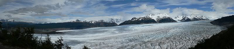
Southern Patagonian Ice Field mantles a great portion of the park.


No comments:
Post a Comment