

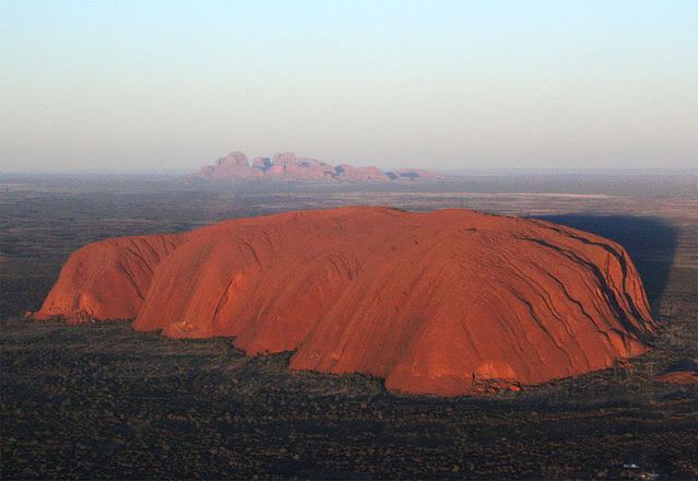
Uluṟu-Kata Tjuṯa National Park is situated in the Northern Territory of Australia. The park extents in an area of 1398 km2 and includes two characteristic rocky formations which are Uluru/Ayers Rock and, 40 kilometres to its west, Kata Tjuta/Mount Olga.
The Park is listed both as an UNESCO World Heritage natural property and cultural landscape. This rare dual World Heritage-listing is given as its features Uluru and Kata Tjuta have great cultural significance for the Anangu native people by whom these places are declared as sacred sites.
The aboriginals believe that the spirit that turned into Ayers rock was a turtlespirit as their culture has always existed in the Central Australian landscape and was created at the beginning of time by ancestral beings. Uluru and Kata Tjuta provide physical evidence of feats performed during the creation period.
The park receives an average rainfall of 307.7 millimeters per year. Temperature extremes in the park have been recorded at 45°C during the summer and -5°C during winter nights. While the Central Australian environment may at first seem stark - a barren landscape supporting spectacular rock formations - closer inspection reveals it as a complex ecosystem, full of life. Local Aboriginal people recognise five seasons:
1.Piriyakutu (August/September) - Animals breed and food plants flower
2.Mai Wiyaringkupai (November/December) - The hot season when food becomes scarce
3.Itjanu (January/February/March) - Sporadic storms can roll in suddenly
4.Wanitjunkupai (April/May) - Cooler weather
5.Wari (June/July) - Cold season bringing morning frosts
Historically, 46 species of native mammals are known to have been living in the Park region; but according to recent surveys there are currently 21. Aṉangu acknowledge that a decrease in the number has implications for the condition and health of the landscape. Moves are supported for the reintroduction of locally extinct animals
Mulgara, the only mammal listed as vulnerable, is mostly restricted to the transitional sand plain area, a narrow band of country that stretches from the vicinity of Uluru to the Northern boundary of the park and into Ayers Rock Resort. This area also contains the marsupial mole, and Woma Python
Four species of frog are abundant at the base of Uluru and Kata Tjuta following summer rains. The Great Desert Skink is listed as vulnerable
The bat population of the park comprises at least seven species that depend on day roosting sites within caves and crevices of Uluru and Kata Tjuta. Most of the bats forage for aerial prey within 100m or so from the rock face. The park has a very rich reptile fauna of high conservation significance with 73 species having been reliably recorded.
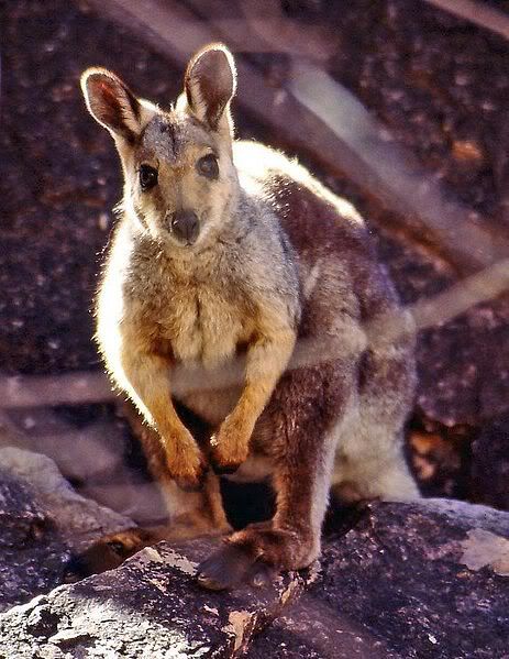
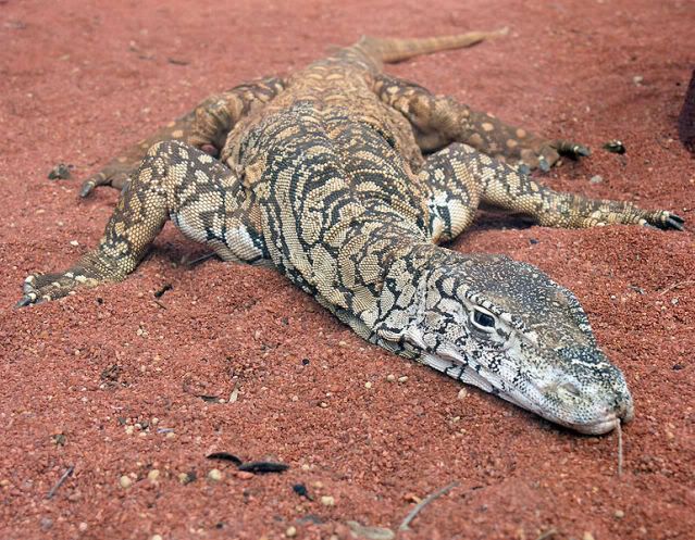
Aṉangu continue to hunt and gather animal species in remote areas of the park. Hunting is largely confined to the Red Kangaroo, Bush Turkey, Emu and lizards such as the Sand Goanna and Perentie.
Of the 27 mammal species found in the park, six are introduced: the House Mouse, camel, fox, cat, dog and rabbit. These species are distributed throughout the park but their densities are greatest in the rich water run-off areas of Uluru and Kata Tjuta.
Uluru - Kata Tjuta National Park flora represents a large portion of plants found in Central Australia. A number of these endemic plants like Adder's Tongue ferns are considered rare and are restricted in the park.
The growth and reproduction of plant communities rely on irregular rainfall. Some plants are able to survive fire and some are dependent on it to reproduce. Many plants are associated with ancestral beings.
Flora in Uluru - Kata Tjuta National Park can be broken into the following categories:
1.Punu – trees
2.Puti – shrubs
3.Tjulpun-tjulpunpa – flowers
4.Ukiri – grasses
Trees such as the Mulga and Centralian Bloodwood are used to make tools such as spearheads, boomerangs and bowls. The red sap, of the bloodwood is used as a disinfectant and an inhalant for coughs and colds.
Since the first Europeans arrived, 34 exotic plant species have been recorded in the park, representing about 6.4% of the total park flora. Some, such as perennial buffel grass (Cenchrus ciliaris), were introduced to rehabilitate areas damaged by erosion. It is the most threatening weed in the park and has spread to invade water- and nutrient-rich drainage lines. A few others, such as burrgrass, were brought in accidentally, carried on cars and people.
From a geological point of view, analysis of Uluru-Kata Tjuta National Park reveals an awe-inspiring history.
Both Uluru and Kata Tjuta are left overs of a huge sediment that has formed as 500 million years ago, when the entire area was covered by an inland sea and sand was laid down in the formed basin. Material continued to collect at the bottom of this ancient sea bed until about 300 million years ago when the area was lifted and folded and mountain ranges were formed and as a consequence the seas disappeared. These ranges eroded in the following millions of years, leaving huge sediments at the bottom. The remaining sediment was folded and fractured again. In this major process the sediment layers that now form Uluru were tilted, so that today they are at a 85° angle. Kata Tjuta was tilted some 20.
The whole region was lifted up even more above sea level in the process. This means Uluru and Kata Tjuta are the only visible tips of a massive underground rock slab. You could even argue that the description of Uluru as a monolith is inaccurate, as it is actually part of this huge underground rock formation that also includes Kata Tjuta.
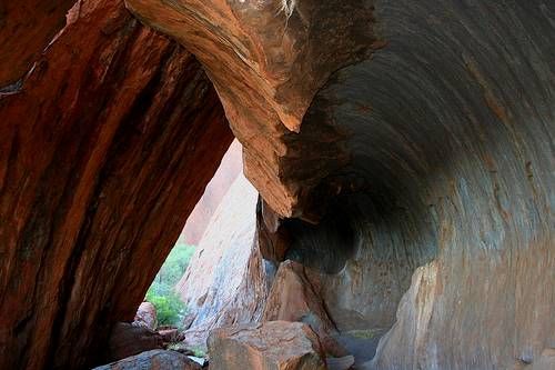
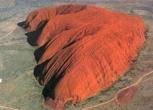
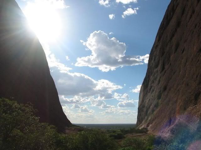
The intriguing sculpted shapes, valleys and ridges, caves, potholes and plunge pools are the result of the last few hundreds of millions of years of air and rain erosion. The flaky surface is due to chemical decomposition

Uluru is actually a relic of the coarse grained, mineral-rich sandstone called arkose. whereas Kata Tjuta is a conglomerate of gravel and boulders, cemented together by mud and sand. Its domes are the eroded remains of the sedimentary rock from the seabed.
Archaeological findings to the east and west indicate that humans settled in the area more than 10,000 years ago.
Europeans came to the western desert area of Australia in the 1870s. Uluru and Kata Tjuta were first mapped by Europeans during the expeditionary period made possible by the construction of the Overland Telegraph Line in 1872.
In separate expeditions, William Ernest Powell Giles and William Christie Gosse were the first European explorers to this area. In 1872 while exploring the area, Ernest Giles sighted Kata Tjuta from near Kings Canyon and called it Mount Olga, while the following year Gosse saw Uluru and named it Ayers Rock on behalf of Sir Henry Ayers, a Chief Secretary of South Australia.
In the late 1800s, pastoralists attempted to re-establish themselves in the area and interaction between Anangu and white people became more frequent and more violent. In 1920, part of Uluru - Kata Tjuta National Park was declared an Aboriginal Reserve (commonly known as the South-Western or Petermann Reserve) by the Australian government under the Aboriginals Ordinance.
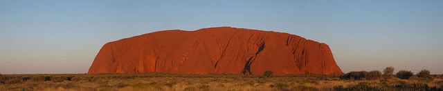
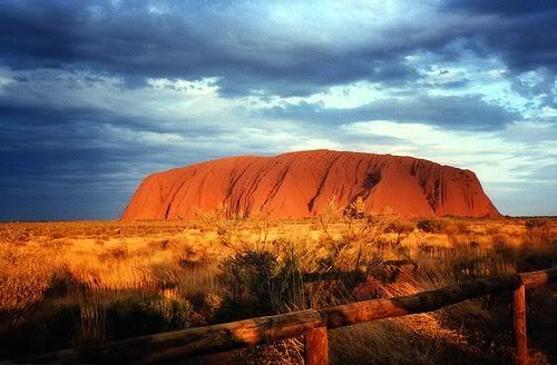
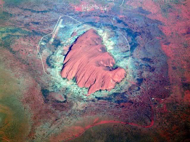
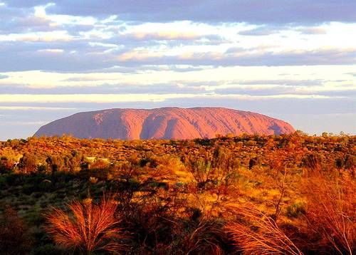
Uluru is Australia’s most recognisable natural icon. The world-renowned sandstone inselberg literally "island mountain" stands 348 metres high (863 m above sea level) and it covers 3.33 km2. It also extends 2.5 km or even more into the ground. It was described by explorer Ernest Giles in 1872 as "the remarkable pebble"
The local Pitjantjatjara people call the landmark Uluṟu (IPA:[uluɻu]). On 19 July 1873, the surveyor William Gosse visited Uluṟu and named it Ayers Rock in honour of the then-Chief Secretary of South Australia, Sir Henry Ayers.Since then, both names have been used, although Ayers Rock was the most common name used by outsiders until recently.
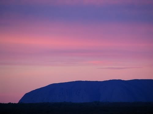
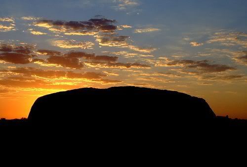
Uluru is naturally grey, but the iron content of the rock is "rusting" at the surface, resulting in the distinctive red iron oxide coating. However Uluru is notable for appearing to change colour to anything from blue and violet to glowing red as light strikes it at different times of the day and year. Although rainfall is uncommon in this semiarid area, during wet periods the rock acquires a silvery-grey colour, with streaks of black algae forming on the areas that serve as channels for water flow. Some report that there is even a light source emanating at various times of the year. Most likely this can be explained scientifically.
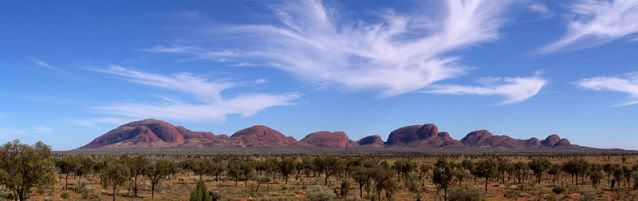
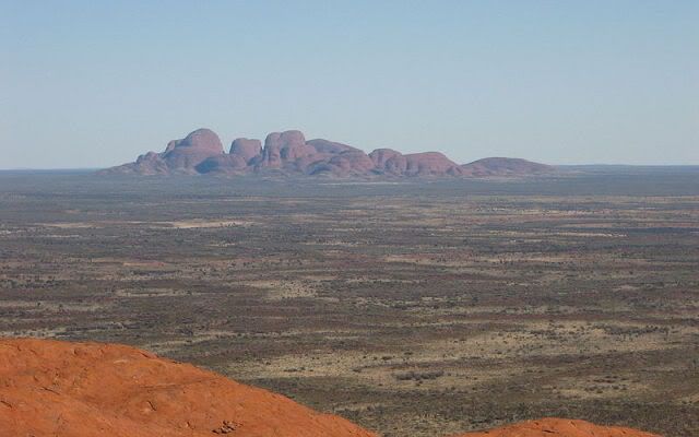
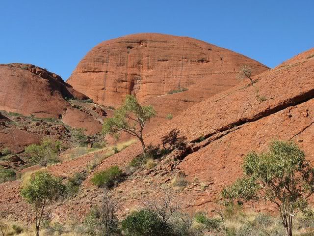
Kata Tjuta, sometimes written Kata Tjuta {Kata Joota}, and also known as Mount Olga (or colloquially as The Olgas), are a group of large domed rock formations located about, 25 km to the east of Uluru. The 36 domes, covering an area of 21.68 km², are composed of conglomerate, a sedimentary rock consisting of cobbles and boulders of varying rock types including granite and basalt, cemented by a matrix of sandstone.
The highest point, Mount Olga, is 1066 m above sea level, or approximately 546 m above the surrounding plain (198 m higher than Uluru).

